

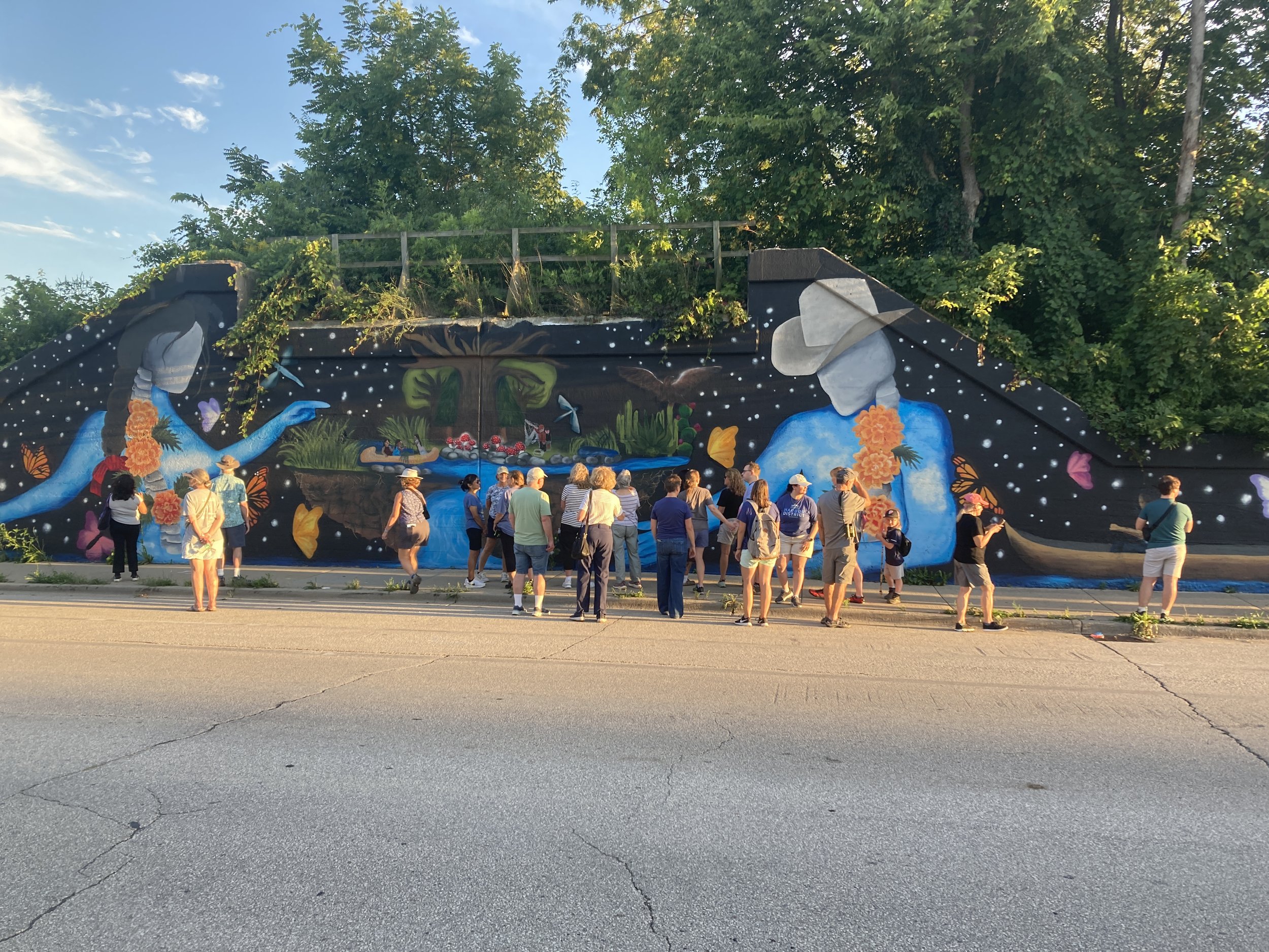
‘F’ is for Family, Felicidad, Fish
The Kinnickinnic River at 6th Street
The mural by Yesi Pérez on Lincoln Avenue just east of First Street was supported through WaterMarks and is marked by the blue “F” standing along Sixth Street near Cleveland Avenue just south of the bridge over the Kinnickinnic River. Both are connected by the public KK River Trail.
Artist Perez, neighborhood organizer Travis Hope, and public health researcher Dr. Kirsten Beyer of Medical College of Wisconsin led community walks along the Kinnickinnic River Trail and near Pulaski Park as part of WaterMarks, focusing on the benefits of mindfulness in nature.
The “F” marker is one of several along the Kinnickinnic River including the Ñ near Pulaski Park and the H at Harbor View Plaza and the Kinnickinnic River turning basin.
You can discover more about the ongoing transformation of the Kinnickinnic River below and through the Ñ page.
The word Kinnickinnic comes from the Ojibwe language meaning "what is mixed." (The word referred to local plants mixed with tobacco to be smoked.) Today, the word aptly describes a new kind of mixture—a densely populated, ethnically diverse, and culturally rich neighborhood sharing as a common thread its namesake river: the KK. Instead of herbs and plants and bark, this mixture includes people of many ages, languages, and backgrounds—not just neighbors living next door to each other but members of a community finding new ways to care for one another, the land, and our water.
"We're packed," says Esperanza Gutierrez, a passionate member of the local neighborhood organization, the Kinnickinnic River Neighbors in Action. "It's the most dense neighborhood in the city, and it's the most youthful neighborhood. So we need to teach our young children self-respect, respect for their neighbors, and the respect for nature."
Enjoy snapshots of yesterday, today, & tomorrow…

Yesterday: Looking west from 11th Street (1961) Homes and businesses tightly packed along the armored banks of the Kinnickinnic River in this June 1961 photo. The KK River watershed is the most densely populated watershed in Wisconsin. The banks of the river and its tributaries were originally armored to reduce flooding by conveying stormwater faster through the trapezoidal channel, but the strategy backfired as the surrounding watershed was developed with hard surfaces. Bridges constricted high flows, and severe floods escaped the banks. The loss of habitat also degraded water quality, leading to its perception as a drainage ditch. Photo courtesy of MMSD / Tom Chapman

Today: Looking east from 16th Street along the Kinnickinnic River in its concrete trapezoidal channel. Eighty-four homes were removed adjacent to the river so that this reach can be re-engineered to allow the river to meander through a broader floodplain. That should reduce flood risk and dangerous flows where people have drowned. Image courtesy Sixteenth Street Community Health Centers.

Tomorrow: Looking east in Pulaski Park (future vision) This rendering shows what Pulaski Park could look like in the future as more concrete is removed, trees are planted, and a walking path is connected. Neighbors can provide input on what they would like to see along the river corridor by participating in the KK River Neighbors in Action. Even more dramatic transformations are planned downstream between 16th and Sixth streets. Image courtesy Sixteenth Street Community Health Centers.
KK River Voices

Meet Travis

Meet Marisela

Meet Esperanza